Category: Spatial Data Analysis
-
Europe’s Protected Lands Over the Last Two Decades

There has been a big push in the last few years to ensure that our natural areas are protected by some sort of law, regulation, governing body, park service, etc. How has this changed in Europe, specifically? Play the video below to see how my map answers this question by visualizing data taken from the…
-
Flood Zone Reporting App
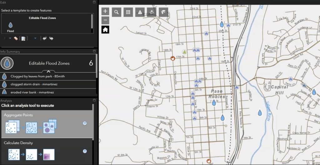
I built a flood zone reporting app in ArcGIS WebApp Builder to encourage community reporting with various helpful widgets. Community members create new points on the map to report flood zones with the ability to add notes on flood sources, noticeable hazards, etc. Everything is served on ArcGIS Server Manager and programmed so that new…
