-
Fishing & Hunting in Pennsylvania
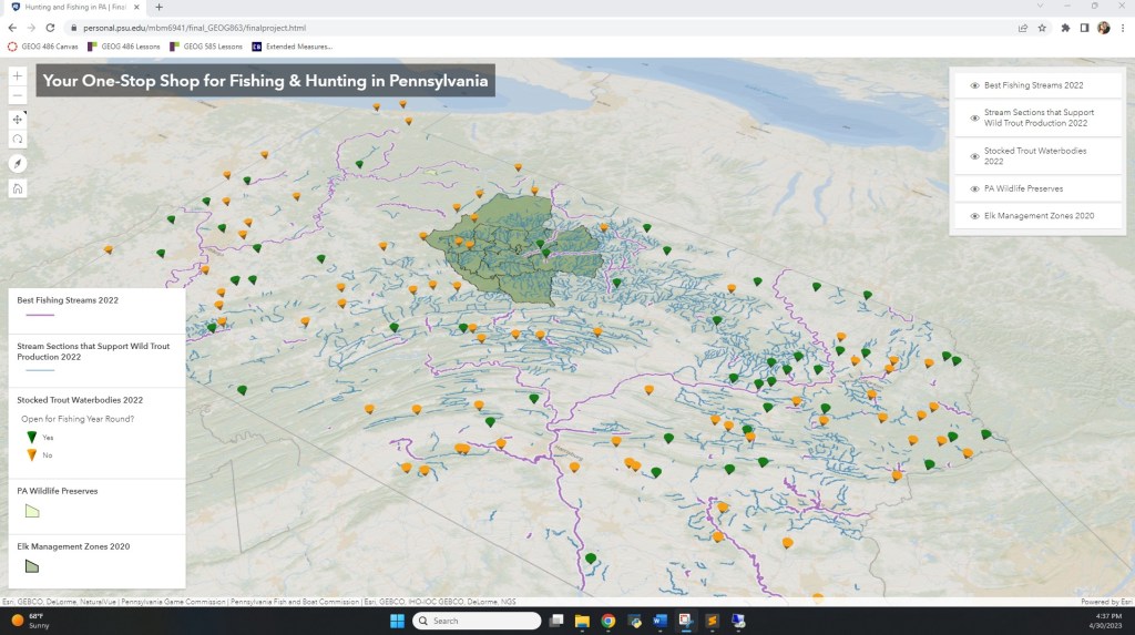
I created a “one-stop shop” interactive web app for someone interested in ecologically-conscious fishing & hunting in the state of Pennsylvania. I created my own instance of ArcGIS Server, found, extracted, prepped, and published data on that instance, and then developed the web app using JavaScript, ArcGIS API for JavaScript, HTML, CSS, and the data…
-
EV Chargers & Outdoor Recreation
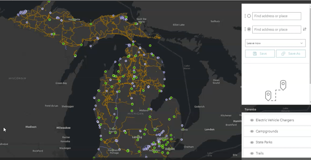
We want people to use alternative fuel options, but we aren’t giving them the resources with which to do it. I love the outdoors, I want to enjoy it, and I want to preserve it. But it’s hard to do that in an electric vehicle without a LOT of planning; in general, it’s inaccessible, and…
-
Europe’s Protected Lands Over the Last Two Decades

There has been a big push in the last few years to ensure that our natural areas are protected by some sort of law, regulation, governing body, park service, etc. How has this changed in Europe, specifically? Play the video below to see how my map answers this question by visualizing data taken from the…
-
Flood Zone Reporting App
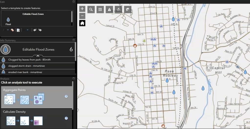
I built a flood zone reporting app in ArcGIS WebApp Builder to encourage community reporting with various helpful widgets. Community members create new points on the map to report flood zones with the ability to add notes on flood sources, noticeable hazards, etc. Everything is served on ArcGIS Server Manager and programmed so that new…
-
Surfing in Nosara

I created a map for a Costa Rican surf shop to provide to their customers traveling in from outside the area. Customers can see hotel options in the town listed cheapest to most expensive in the legend and find their proximity to the beach on the map. Resources (like pharmacies and police stations) and surfing-focused…
-
Michigan State Campgrounds
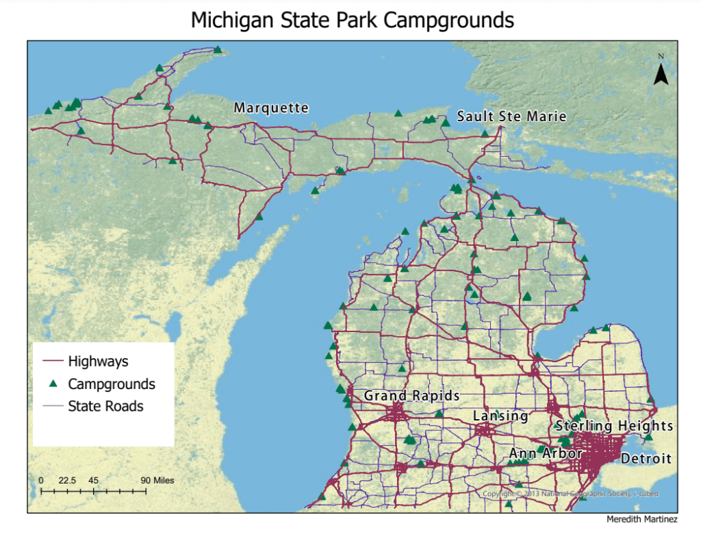
Map of Michigan State Park Campgrounds with highways, state roads, and major cities labeled. Created in ArcGIS Pro.
-
Cartographic Labeling & Map Design
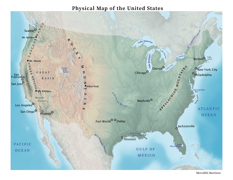
Geographic & Physical Map of the United States, created in Adobe Illustrator
-
Subscribe
Subscribed
Already have a WordPress.com account? Log in now.
